| TITLE (to click on) | Date |
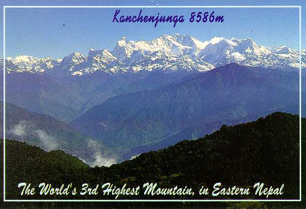
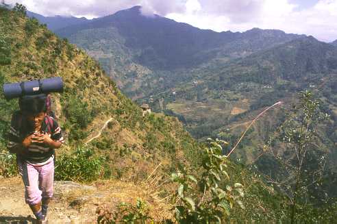
| Kangchenjunga (8598 m, below 'g' of Kangchenjunga) and
Yannu Mountains (7710 m, below 'a' of Kangchenjunga), view from Basantapur to the NNE.
Our trek followed the main valley above '3rd' till the back (North side)
of the Yannu and Kangchenjunga Mountains. |
Oct/Nov 1999 |
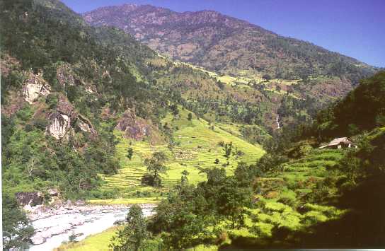
| Rice (low) and millet (higher) fields near Dhoban (altitude 640 m). |
Oct/Nov 1999 |
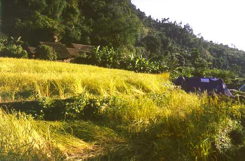
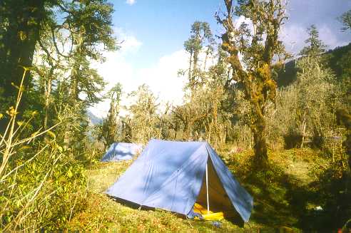
| Camp (right) in rice fields surrounded by banana trees in Mitlung
(altitude 1140 m). |
Oct/Nov 1999 |
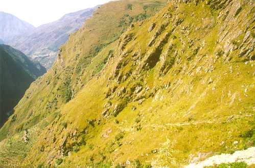
| Steep cliffs along main path from
Taplejung to Ghunsa, between Sakathum and Amjilassa (altitude 2430 m). This portion is a bit treacherous. |
Oct/Nov 1999 |
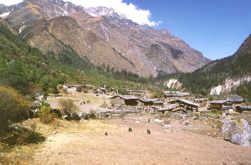
| Tibetan village of Phale (altitude 3140 m), just before Ghunsa. |
Oct/Nov 1999 |
| Boudhist prayer site in Phale. |
Oct/Nov 1999 |
| Main valley before Ghunsa (altitude 3300 m). |
Oct/Nov 1999 |
| Main valley just before Ghunsa, with carrying zopkiok
(male cross-breed yak and cow). |
Oct/Nov 1999 |
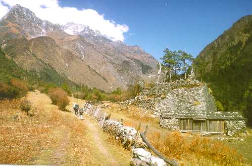
| The village of Ghunsa (altitude 3795 m) with bridge. |
Oct/Nov 1999 |
| The village of Ghunsa (altitude 3795 m) with house of Dorje Sherpa inlaws. |
Oct/Nov 1999 |
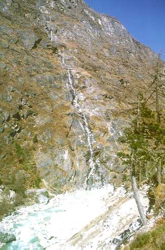
| High (500 m) waterval between Ghunsa and Kambachen. |
Oct/Nov 1999 |
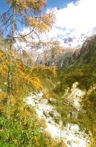
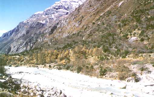
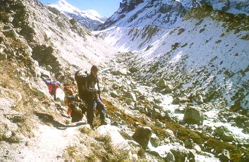
| Valley between Ghunsa and Kambachen at 3600 m altitude. |
Oct/Nov 1999 |
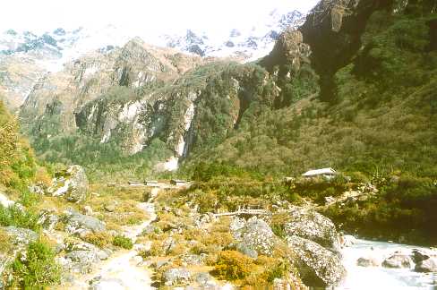
| Forest between Ghunsa and Kambachen at 3800 m altiude. |
Oct/Nov 1999 |
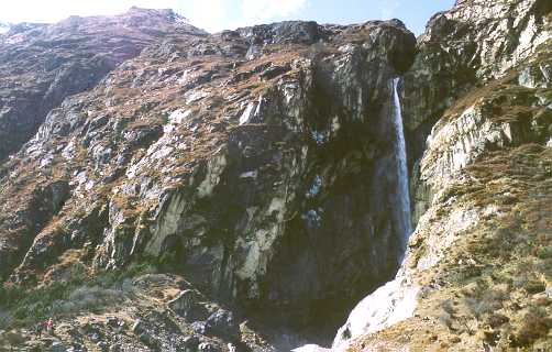
| Waterval between Ghunsa and Kambachen at 3600 m altitude. Cliff is around 100 m high. |
Oct/Nov 1999 |
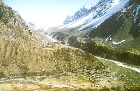
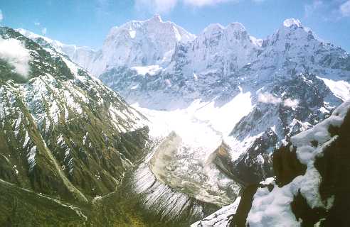
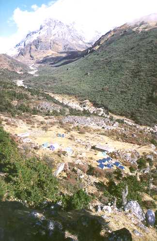
| Kambachen, 4000 m altitude. Main Kangchenjunga glacier valley
and Drohma Peak far back-ground. Temperature around -8 Degrees Celcius at night in
November, +12 Degrees Celcius during the day. |
Oct/Nov 1999 |
| Glacial breach in end moraine of Kangchenjunga
and Ramtang Glaciers between Kambachen and Lhonak at 4300 m altitude. This caused a glacial lake outburst
flood (GLOF) a few thousand years ago. |
Oct/Nov 1999 |
| View at Yannu glacier from mountain 400 m up from Kambachen. |
Oct/Nov 1999 |
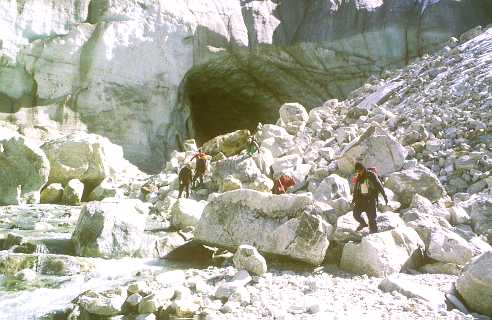
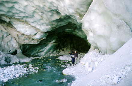
| Yannu glacier at 4200 m altitude, with subterrean glacier river cave. |
Oct/Nov 1999 |
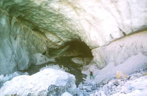
| Yannu glacier at 4200 m altitude, Ang Dorje Sherpa in subterranean glacier river cave. |
Oct/Nov 1999 |
| Yannu glacier at 4200 m altitude, Phurba Sherpa and Jean in subterranean glacier river cave. |
Oct/Nov 1999 |
| Panorama of the hamlet of Lhonak (altitude 4785 m), with teashops. Our tents to the right.
Temperature around -18 Degrees Celcius at night in November,
+5 Degrees Celcius during the day, -14 Debrees Celcius at breakfast (7 AM).
Far back-ground right is valley towards the 5800 m high pass to Tibet, used in the summer by yak caravans for trading. |
Oct/Nov 1999 |
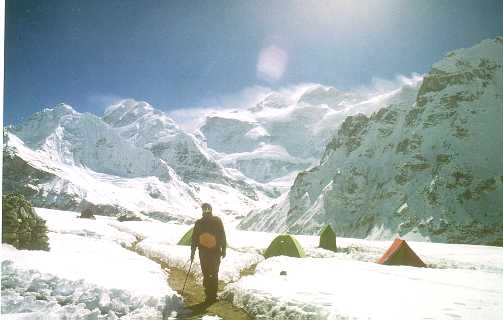
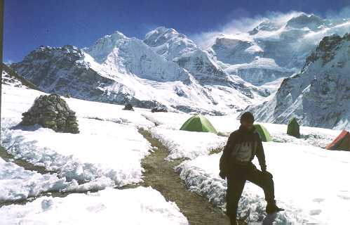
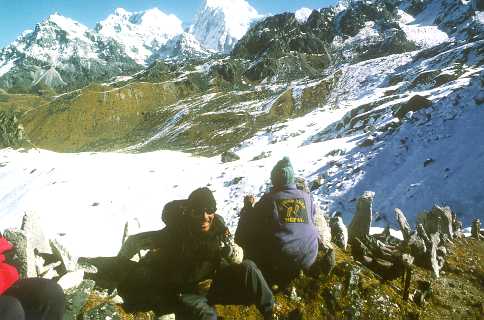
| Kangchenjuna (8598 m), third highest mountain in
the world. View from Kangchenjunga Base Camp at around 5000 m altitude.
Jean in front of it, completely bundled up, with shiny snowglasses.
Temperature around -2 Celcius during the day in November, much lower (-20 to -25?) during the night. |
Oct/Nov 1999 |
| Same, but with chief Sherpa guide (Sirdar) Phurba Sherpa
(from near Paphlu in the Everest Region). |
Oct/Nov 1999 |
| Phurba Sherpa at 3800 m altitude, with Ghunsa - Kambachen valley in the background. |
Oct/Nov 1999 |
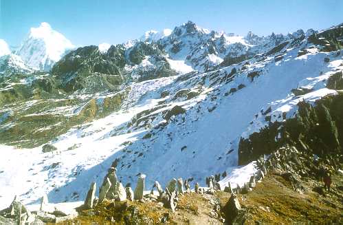
| Sinion La Pass (4440 m altitude), between Ghunsa and Tseram. With upright prayer stones. |
Oct/Nov 1999 |
| Phurba at Sinion La Pass (4440 m altitude), with Boudhist
prayer flags and Yannu Mountain (7710 m) in the background. |
Oct/Nov 1999 |
| Same, with Sponsortrek Coat. |
Oct/Nov 1999 |
| Same, with Everest and Lhotze (middle, faint) in the far distance. |
Oct/Nov 1999 |
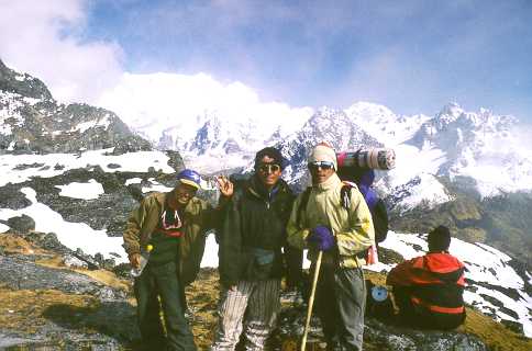
| Ang Yok Pu, Ang Dorje and Sunam Sherpa (our mountain guides) on the
Sinelapche pass (4640 m altitude), with Yalung Ka (ridge). Near Kangchenjunga Base Camp South. |
Oct/Nov 1999 |
| Hamlet of Tseram (3980 m altitude)
| Oct/Nov 1999 |
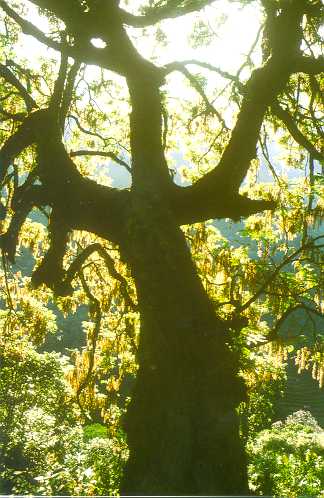
| Tree in the valley between Tseram and Torontian (3500 m altitude). |
Oct/Nov 1999 |
| Jungle camp, near Torontian (3000 m altitude). |
Oct/Nov 1999 |
| House near Yamphuding (1990 m altitude). |
Oct/Nov 1999 |
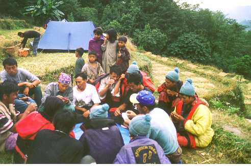
| Camp and playing cards in rice field camp near Kunjari (1928 m altitude). |
Oct/Nov 1999 |
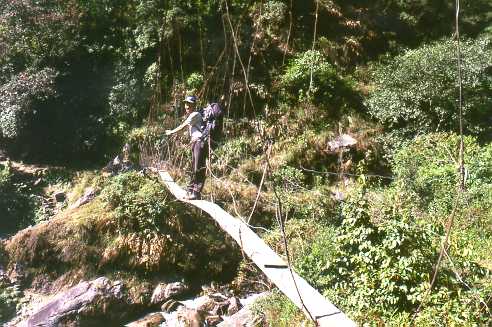
| Old, swinging bridge with Phurba Sherpa. Bit unsafe, only used during the monsoon. |
Oct/Nov 1999 |
| House and rice fields near Tambema (2000 m altitude). |
Oct/Nov 1999 |
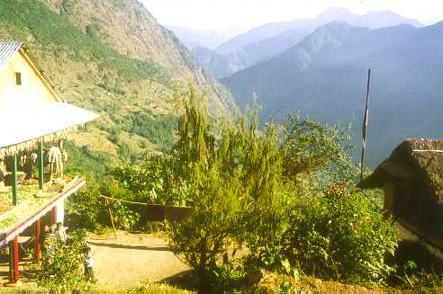
| Cook Joklal Tamang with a view at the valley of the Phawa Khola (relief around 1000 m). |
Oct/Nov 1999 |
| Old lady in Taplejung, with big gold ear rings (1824 m altitude). |
Oct/Nov 1999 |
| Shopping street in Taplejung, a district capital in North-Eastern Nepal, with school girls. |
Oct/Nov 1999 |
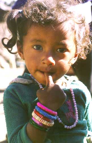
| Young girl near Basantapur, with fake pearl necklace. |
Oct/Nov 1999 |
| Suketar Airport or landing strip (2420 m altitude), Twin Otter plane
taking off from the 600 m long grassy (and bumby) run way. Porters in the foreground. |
Oct/Nov 1999 |
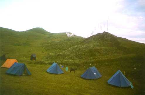
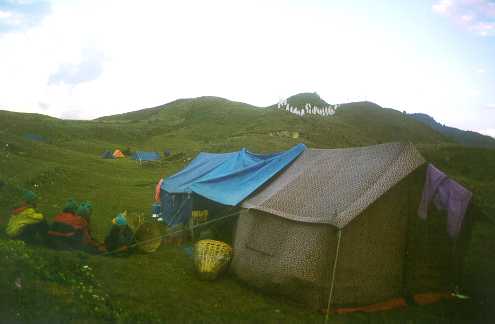
| Our tourist tents near Suketar Airport (2420 m altitude). |
Oct/Nov 1999 |
| Our kitchen and dining tent near Suketar Airport (2420 m altitude).
Flags on the hill for the new year festival. |
Oct/Nov 1999 |
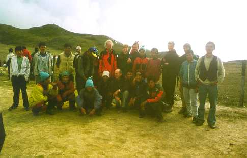
| Kangchenjunga trekking group of Oct/Nov 1999 at Suketar Airport (2420 m altitude).
10 out of 20 porters present (some with blue hats) |
Oct/Nov 1999 |
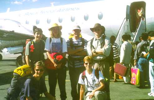
| 6 Dutch tourist of the Kangchenjunga trek of 1999 or "Chete Yanis" (Nepalese for "white monkeys").
Standing left to right: Ineke, Erika, Edwin, Jean. Sitting left to right: Ursula, Hannie. |
Oct/Nov 1999 |